John Wayne Pioneer Trail / Iron Horse State Park
Key Info
Stats
General
The official name of this popular rail trail is the John Wayne Pioneer Trail. A good portion of this trail is in the 100 foot wide Iron Horse State Park. Yup, it's confusing, but you're looking in the right place.
This gravel surfaced rail trail follows an old railroad line up to, and under, Snoqualmie Pass and takes you all the way to the Columbia River. There are plans to extend the trail all the way to Idaho. The surface is smooth gravel and the grade is never over 2.2%. Any bike will work on some parts of this trail, but wide tires are nice on the gravel, which can be a bit loose in certain sections.
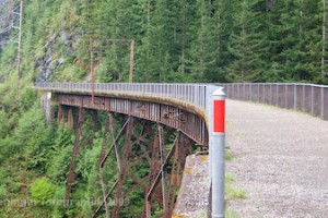
The trail starts on the Seattle side at Rattlesnake Lake and climbs gently up towards Snoqualmie Pass, crossing over several old railroad trestles. Just before the pass the trail goes into the 2.3 mile Snoqualmie Tunnel under Snoqualmie Pass and comes out near Hyak. You'll need lights to go through the tunnel.
From Hyak the trail gently descends towards the Columbia River through the sunny and dry Eastern Washington Steppe. On the way you'll cross through several tunnels, over several trestles, and go through the Army's Yakima Firing Range.
On the east side of the Columbia, the corridor is managed by the DNR, and you need a permit to use it. If you contact their Southeast Region Office, they will send you a information packet with detailed maps. They will also have information on trail conditions.
DNR Southeast Region 713 E. Bowers Rd. Ellensburg, WA 98926 (509) 925-8510
This West Cascades part of this trail has a well maintained gravel surface and there are rarely any potholes. East of Snoqualmie Pass the trail has a variable surface. Most of the time it is nice hard gravel, but there are a few spots where the surface is a bit looser. Generally, the further east you get, the looser the trail surface becomes. East of the Thorp trailhead, you'll find little to no shade - it get's hot in the summer! East of Ellensburg, the trail becomes quite loose and riding can be difficult.
The ride between the South CleElum trailhead and the Thorp trailhead passes through the upper Yakima River canyon and is quite nice. There are two small tunnels in this section, and it's best to have a flashlight handy.
The Snoqualmie tunnel is closed annually from Nov. 1 until May 1, depending on conditions.
The Snoqualmie Pass tunnel needs significant maintenance and State Parks is seeking funding for the repairs. The work needed is to keep the lining of the tunnel from falling apart and could cost upwards of $10 million. The tunnel may be closed in the future for safety reasons and State Parks is considering on-grade reroutes to keep the trail open across the pass.
The Army owns the section of the trail between the Columbia River and Boylston and there are occassional rumblings that they will close it to public use.
Ride Reports
Just past the new Olallie Trialhead, there was a fill that Chicago / Milwaukie put in get the small valley a creek flows down, up to the railroad grade. They used timbers to create a structure, like coffer dams, that helped to keep the steep sides of the fill in place. Many decades la...
This is a blast! Was a little too warm and soft snow takes more effort to ride. Best if its colder than 35 degrees. Rode 19 miles from Crystal Springs. Requires a daily snow park pass of $20.
Weekend of 3/24 is supposed to be snowing and I am going again. The cardio workout is 80% to ridi...
After parking at Cedar Falls trailhead in Iron Horse SP, and after finishing a ride on the trial, I headed over to take a look at the lake. The water level on Rattlesnake Lake is really low, so a trip around the lake at shoreline is possible. Lots of rock and some mud, but a fun little ride. Didn...
I brought my 11yo son and 7yo daughter for a ride through the tunnel yesterday. We had ample lighting (a must, because it is DARK in there), but not ample attire; I insisted they have jackets, but it was even chillier than I expected. Gloves and warm pants would have helped! They enjo...
A friend and I started at the Ceder Falls trailhead and begain the 40 mile ride to the Lake Easton State Park for an overnight and back. It was a great weekend. The trail was in great shape all the way and the tunnel "air conditioning" was a welcome cooling on the warm day, both ways. I was pulli...
Hi-yah!
This is my 3rd adventure parking at Rattlesnake Lake and riding to and through the Snoqualmie tunnel, then back to Rattlesnake Lake. This path is relaxing at the same time I get the feeling of being in a natural environment. It's good for family cause it doesn't have strenuos rock...
John Wayne Trail – Rattle Snake Lake Trailhead to Wanapum Recreation Area, Vantage WA.
6/19-6/20
Day One – Rattle Snake Lake to Cle Elum
There were four of us that did this ride. We had two full...
I rode the trail from Ellensburg to just past the first tunnel and took a rest at the old cattle ranch homestead before returning home. It's a gentle 30 mile round trip and the temperatures were great, maybe 85. The trail is in really good shape, with 2 "lanes" clearly visible in the...
Had a great two-day tour pulling my BoB trailer on the Iron Horse Trail (aka: JWPT) from its start in North Bend on out to Wanapum State Park near Vantage. There are a couple of sections of loose gravel: 4-5 frustrating miles' worth just east of Hyak, then a mile or two of it east of Cle Elum. I...
Great Winter spin to the Tunnel and back from SVT in North Bend


 (technical difficulty)
 (physical difficulty)

